Ville de Wandandian (New South Wales)
Informations
Chiffres
- Code pays :
- AU
- Code postal :
- 2540
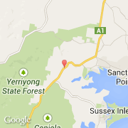
- Latitude :
- -35.08907
- Longitude :
- 150.50997
- Zone horaire :
- Australia/Sydney
- Fuseau horaire :
- UTC+10
- Heure d'été :
- Y
La ville de Wandandian appartient à l'état New South Wales et à la région Country West.
La ville de Wandandian compte 440 habitants.
Le nom anglais de la ville est Wandandian.
Le site Internet de Wandandian est http://www.censusdata.abs.gov.au
©photo-libre.fr