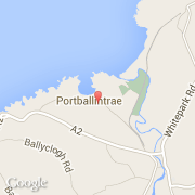
Ville de Portballintrae (Northern Ireland)

royaume-uni

Informations

Chiffres

Code pays :
GB
Code postal :
BT57
Latitude :
55.21488
Longitude :
-6.54433
Zone horaire :
Europe/London
Fuseau horaire :
UTC
Heure d'été :
Y

La ville de Portballintrae appartient à la nation Northern Ireland et au comté Coleraine.

La ville de Portballintrae compte 734 habitants.

Villes voisines

  • Bushmills ~2 km
  • Urbalreagh ~4 km
  • Castlecatt ~6 km
  • Islandcarragh ~7 km
  • Craigahullier ~6 km
  • Derry Keighan ~9 km
  • Ballybogy ~10 km
  • Cloyfin ~9 km
  • Dunseverick ~6 km
Booking.com

Rejoignez-nous !

Vous aimez ? Partagez !