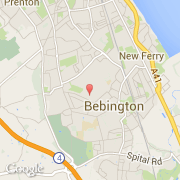
Ville de Bebington (England)
Informations
Chiffres
- Code pays :
- GB
- Code postal :
- CH63
- Latitude :
- 53.35326
- Longitude :
- -3.01520
- Zone horaire :
- Europe/London
- Fuseau horaire :
- UTC
- Heure d'été :
- Y
La ville de Bebington appartient à la nation England, au comté Merseyside et au district Wirral.
La ville de Bebington s'étend sur 16,29 km² et compte 13 720 habitants (recensement de 2001) pour une densité de 842,23 habitants par km².
Le nom espagnol est Bebington.
©photo-libre.fr