Ville de Líbeznice (Hlavní město Praha)
Informations
Chiffres
- Code pays :
- CZ
- Code postal :
- 250-64
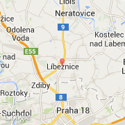
- Latitude :
- 50.19193
- Longitude :
- 14.49368
- Zone horaire :
- Europe/Prague
- Fuseau horaire :
- UTC+1
- Heure d'été :
- Y
La ville de Líbeznice appartient à la région Hlavní město Praha, au district Praha-východ et à la commune Měšice u Prahy.
La ville de Líbeznice compte 1 522 habitants (recensement de 2011). L'altitude moyenne est de 203 m.
Le nom anglais de la ville est Líbeznice.
©photo-libre.fr