Ville de Trotwood (Ohio)
Informations
Chiffres
- Code pays :
- US
- Code postal :
- 45406
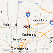
- Latitude :
- 39.79421
- Longitude :
- -84.27011
- Zone horaire :
- America/New_York
- Fuseau horaire :
- UTC-5
- Heure d'été :
- Y
La ville de Trotwood appartient à l'état Ohio et au comté Montgomery.
La ville de Trotwood s'étend sur 78,99 km².
Le maire de la ville de Trotwood est actuellement Michael J. Lucking.
Le site Internet de Trotwood est http://www.census.gov
©photo-libre.fr