Ville de Knightsville (Indiana)
Informations
Chiffres
- Code pays :
- US
- Code postal :
- 47857
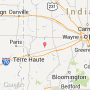
- Latitude :
- 39.57741
- Longitude :
- -87.05744
- Zone horaire :
- America/Indiana/Indianapolis
- Fuseau horaire :
- UTC-5
- Heure d'été :
- Y
La ville de Knightsville appartient à l'état Indiana et au comté Clay.
Le site Internet de Knightsville est http://www.census.gov
©photo-libre.fr