Ville de Fort Leavenworth (Kansas)
Informations
Chiffres
- Code pays :
- US
- Code postal :
- 66027
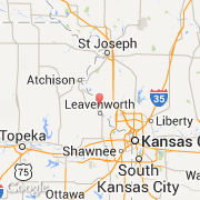
- Latitude :
- 39.36160
- Longitude :
- -94.92370
- Zone horaire :
- America/Chicago
- Fuseau horaire :
- UTC-6
- Heure d'été :
- Y
La ville de Fort Leavenworth appartient à l'état Kansas et au comté Leavenworth.
Le nom anglais de la ville est Fort Leavenworth.
©photo-libre.fr