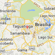
Ville de Taguatinga (Centro-Oeste)
Informations
Chiffres
- Code pays :
- BR
- Code postal :
- 71900-100
- Latitude :
- -15.83773
- Longitude :
- -48.02201
- Zone horaire :
- America/Sao_Paulo
- Fuseau horaire :
- UTC-3
- Heure d'été :
- Y
La ville de Taguatinga appartient à la région Centro-Oeste et à l'état Distrito Federal.
©photo-libre.fr