Ville de Fraiture (Région Wallonne)
Informations
Chiffres
- Code pays :
- BE
- Code postal :
- 4557
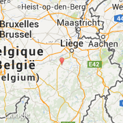
- Latitude :
- 50.47851
- Longitude :
- 5.41935
- Zone horaire :
- Europe/Brussels
- Fuseau horaire :
- UTC+1
- Heure d'été :
- Y
La ville de Fraiture appartient à la région Région Wallonne, à la province Liège, à l'arrondissement Huy et au canton Tinlot.
©photo-libre.fr