Ville de Rathenow (Brandenburg)
Informations
Chiffres
- Code pays :
- DE
- Code postal :
- 14712
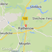
- Latitude :
- 52.60657
- Longitude :
- 12.33756
- Zone horaire :
- Europe/Berlin
- Fuseau horaire :
- UTC+1
- Heure d'été :
- Y
La ville de Rathenow appartient à l'état Brandenburg et au district Havelland.
La ville de Rathenow s'étend sur 105,68 km² et compte 26 433 habitants pour une densité de 250,12 habitants par km². L'altitude moyenne est de 29 m.
Le bourgemestre de la ville de Rathenow est actuellement Ronald Seeger.
Le site Internet de Rathenow est http://www.rathenow.de
©photo-libre.fr