Ville de Gotha (Thüringen)
Informations
Chiffres
- Code pays :
- DE
- Code postal :
- 99867
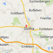
- Latitude :
- 50.94835
- Longitude :
- 10.69727
- Zone horaire :
- Europe/Berlin
- Fuseau horaire :
- UTC+1
- Heure d'été :
- Y
La ville de Gotha appartient à l'état Thüringen et au district Gotha.
La ville de Gotha s'étend sur 69,52 km² et compte 45 593 habitants (recensement de 2010) pour une densité de 655,83 habitants par km². L'altitude moyenne est de 300 m.
Le bourgemestre de la ville de Gotha est actuellement Knut Kreuch.
Le nom français de la ville est Gotha, le nom anglais de la ville est Gotha.
Le site Internet de Gotha est http://www.gotha.de
©photo-libre.fr