Ville de Münchwilen (Thurgovie)
Informations
Chiffres
- Code pays :
- CH
- Code postal :
- 9542
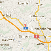
- Latitude :
- 47.47882
- Longitude :
- 8.99821
- Zone horaire :
- Europe/Zurich
- Fuseau horaire :
- UTC+1
- Heure d'été :
- Y
La ville de Münchwilen appartient au canton Thurgovie, au district Münchwilen et à l'arrondissement Münchwilen.
La ville de Münchwilen s'étend sur 7,79 km². L'altitude moyenne est de 515 m.
La langue officiel de la ville est Allemand. Le nom français de la ville est Münchwilen.
Le site Internet de Münchwilen est http://www.muenchwilen.ch
©photo-libre.fr