Ville de Wymondham (England)
Informations
Chiffres
- Code pays :
- GB
- Code postal :
- LE14
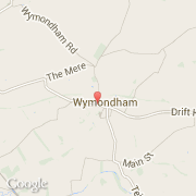
- Latitude :
- 52.76048
- Longitude :
- -0.74022
- Zone horaire :
- Europe/London
- Fuseau horaire :
- UTC
- Heure d'été :
- Y
La ville de Wymondham appartient à la nation England, au comté Leicestershire et au district Melton.
La ville de Wymondham s'étend sur 44,31 km² et compte 23 120 habitants pour une densité de 521,78 habitants par km².
©photo-libre.fr