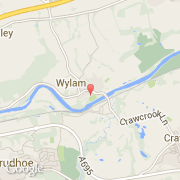
Ville de Wylam (England)
Informations
Chiffres
- Code pays :
- GB
- Code postal :
- NE41
- Latitude :
- 54.97546
- Longitude :
- -1.82061
- Zone horaire :
- Europe/London
- Fuseau horaire :
- UTC
- Heure d'été :
- Y
La ville de Wylam appartient à la nation England, au comté Northumberland et au district Tynedale.
La ville de Wylam compte 2 100 habitants.
©photo-libre.fr