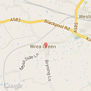
Ville de Wrea Green (England)
Informations
Chiffres
- Code pays :
- GB
- Code postal :
- PR4
- Latitude :
- 53.77570
- Longitude :
- -2.91444
- Zone horaire :
- Europe/London
- Fuseau horaire :
- UTC
- Heure d'été :
- Y
La ville de Wrea Green appartient à la nation England, au comté Lancashire et au district Fylde.
©photo-libre.fr