Ville de Whittlebury (England)
Informations
Chiffres
- Code pays :
- GB
- Code postal :
- NN12
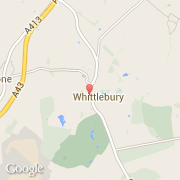
- Latitude :
- 52.08804
- Longitude :
- -0.99255
- Zone horaire :
- Europe/London
- Fuseau horaire :
- UTC
- Heure d'été :
- Y
La ville de Whittlebury appartient à la nation England, au comté Northamptonshire et au district South Northamptonshire.
La ville de Whittlebury compte 586 habitants (recensement de 2001).
Le nom espagnol est Whittlebury.
©photo-libre.fr