Ville de The Hobbins (England)
Informations
Chiffres
- Code pays :
- GB
- Code postal :
- WV15
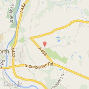
- Latitude :
- 52.53603
- Longitude :
- -2.39015
- Zone horaire :
- Europe/London
- Fuseau horaire :
- UTC
- Heure d'été :
- Y
La ville de The Hobbins appartient à la nation England, au comté Shropshire et au district Bridgnorth.
©photo-libre.fr