Ville de Swanley (England)
Informations
Chiffres
- Code pays :
- GB
- Code postal :
- BR8
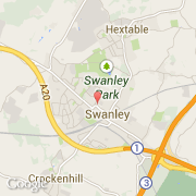
- Latitude :
- 51.39832
- Longitude :
- 0.17427
- Zone horaire :
- Europe/London
- Fuseau horaire :
- UTC
- Heure d'été :
- Y
Informations
Chiffres
Villes voisines
Les transports de Swanley
Informations
Chiffres
Villes voisines
Les transports de Swanley