Ville de Sunderland (England)
Informations
Chiffres
- Code pays :
- GB
- Code postal :
- SR1
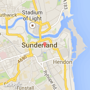
- Latitude :
- 54.90557
- Longitude :
- -1.37987
- Zone horaire :
- Europe/London
- Fuseau horaire :
- UTC
- Heure d'été :
- Y
La ville de Sunderland appartient à la nation England, au comté Tyne and Wear et au district Sunderland.
La ville de Sunderland compte 184 342 habitants (recensement de 2001).
Le nom français de la ville est Sunderland.
©photo-libre.fr