Ville de Strabane (Northern Ireland)
Informations
Chiffres
- Code pays :
- GB
- Code postal :
- BT82
- Latitude :
- 54.82577
- Longitude :
- -7.43314
- Zone horaire :
- Europe/London
- Fuseau horaire :
- UTC
- Heure d'été :
- Y
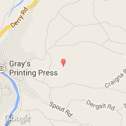
La ville de Strabane appartient à la nation Northern Ireland et au comté Strabane.
La ville de Strabane compte 13 789 habitants (recensement de 1999). L'altitude moyenne est de 65 m.
Le nom français de la ville est Strabane.
Le site Internet de Strabane est http://www.strabanedc.org.uk
©photo-libre.fr