Ville de Stockton (England)
Informations
Chiffres
- Code pays :
- GB
- Code postal :
- NR34
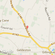
- Latitude :
- 52.48819
- Longitude :
- 1.52350
- Zone horaire :
- Europe/London
- Fuseau horaire :
- UTC
- Heure d'été :
- Y
La ville de Stockton appartient à la nation England, au comté Norfolk et au district South Norfolk.
La ville de Stockton s'étend sur 150,9 km² et compte 291 707 habitants (recensement de 2010) pour une densité de 1 933,11 habitants par km². L'altitude moyenne est de 15 m.
Le maire est Ann Johnston.
Le nom espagnol est Stockton.
Le site Internet de Stockton est http://www.stocktongov.com
©photo-libre.fr