Ville de Stansted (England)
Informations
Chiffres
- Code pays :
- GB
- Code postal :
- CM24
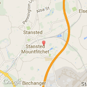
- Latitude :
- 51.89885
- Longitude :
- 0.20473
- Zone horaire :
- Europe/London
- Fuseau horaire :
- UTC
- Heure d'été :
- Y
La ville de Stansted appartient à la nation England, au comté Essex et au district Uttlesford.
La ville de Stansted s'étend sur 7,99 km² et compte 473 habitants (recensement de 2001) pour une densité de 59,20 habitants par km².
Le nom français de la ville est Londres Stansted, le nom anglais de la ville est London Stansted Airport, le nom espagnol est Stansted.
©photo-libre.fr