Villes voisines
- Longlands ~2 km
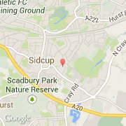
- Sidcup ~2 km
- Falconwood and Welling ~2 km
- Welling ~3 km
- Eltham South ~2 km
- Shooters Hill ~4 km
- Chislehurst ~4 km
- St Pauls Cray ~4 km
- Coldharbour and New Eltham ~3 km
Les transports de Sidcup
- Aéroports internationaux
-
City ~8 km
Gatwick ~38 km
Stansted ~50 km
- Autres transports
-
Biggin Hill ~13 km
London St Pancras ~18 km
St Pancras Railway Station ~19 km
London Euston Railway Station ~19 km
London Victoria Bus Station ~18 km
Villes voisines
- Longlands ~2 km
- Sidcup ~2 km
- Falconwood and Welling ~2 km
- Welling ~3 km
- Eltham South ~2 km
- Shooters Hill ~4 km
- Chislehurst ~4 km
- St Pauls Cray ~4 km
- Coldharbour and New Eltham ~3 km
Les transports de Sidcup
- Aéroports internationaux
-
City ~8 km
Gatwick ~38 km
Stansted ~50 km
- Autres transports
-
Biggin Hill ~13 km
London St Pancras ~18 km
St Pancras Railway Station ~19 km
London Euston Railway Station ~19 km
London Victoria Bus Station ~18 km