Ville de Shap (England)
Informations
Chiffres
- Code pays :
- GB
- Code postal :
- CA10
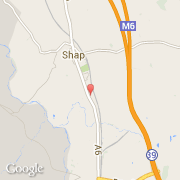
- Latitude :
- 54.52356
- Longitude :
- -2.67228
- Zone horaire :
- Europe/London
- Fuseau horaire :
- UTC
- Heure d'été :
- Y
Informations
Chiffres
Villes voisines
Les transports de Shap
Informations
Chiffres
Villes voisines
Les transports de Shap