Ville de Seaview (England)
Informations
Chiffres
- Code pays :
- GB
- Code postal :
- PO34
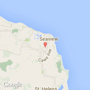
- Latitude :
- 50.71585
- Longitude :
- -1.11432
- Zone horaire :
- Europe/London
- Fuseau horaire :
- UTC
- Heure d'été :
- Y
La ville de Seaview appartient à la nation England et au comté Isle of Wight.
©photo-libre.fr