Ville de Rusper (England)
Informations
Chiffres
- Code pays :
- GB
- Code postal :
- RH12
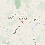
- Latitude :
- 51.12019
- Longitude :
- -0.28052
- Zone horaire :
- Europe/London
- Fuseau horaire :
- UTC
- Heure d'été :
- Y
La ville de Rusper appartient à la nation England, au comté West Sussex et au district Horsham.
La ville de Rusper s'étend sur 25,89 km² et compte 1 389 habitants pour une densité de 53,65 habitants par km².
©photo-libre.fr