Ville de Rowland's Castle (England)
Informations
Chiffres
- Code pays :
- GB
- Code postal :
- PO9
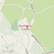
- Latitude :
- 50.89110
- Longitude :
- -0.95708
- Zone horaire :
- Europe/London
- Fuseau horaire :
- UTC
- Heure d'été :
- Y
La ville de Rowland's Castle appartient à la nation England, au comté West Sussex et au district Chichester.
La ville de Rowland's Castle compte 2 770 habitants.
Le site Internet de Rowland's Castle est http://www.neighbourhood.statistics.gov.uk
©photo-libre.fr