Ville de Rotherham (England)
Informations
Chiffres
- Code pays :
- GB
- Code postal :
- S60
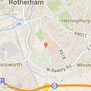
- Latitude :
- 53.41393
- Longitude :
- -1.35014
- Zone horaire :
- Europe/London
- Fuseau horaire :
- UTC
- Heure d'été :
- Y
La ville de Rotherham appartient à la nation England, au comté South Yorkshire et au district Rotherham.
La ville de Rotherham s'étend sur 286,5 km² et compte 117 262 habitants (recensement de 2001) pour une densité de 409,29 habitants par km². L'altitude moyenne est de 71 m.
Pour le mandat 2006-2008.
Le nom français de la ville est Rotherham.
Le site Internet de Rotherham est http://www.rotherham.gov.uk
©photo-libre.fr