Ville de Romford (England)
Informations
Chiffres
- Code pays :
- GB
- Code postal :
- RM5
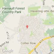
- Latitude :
- 51.60041
- Longitude :
- 0.16383
- Zone horaire :
- Europe/London
- Fuseau horaire :
- UTC
- Heure d'été :
- Y
La ville de Romford appartient à la nation England, au comté Essex et au district Redbridge.
La ville de Romford compte 36 500 habitants (recensement de 2005).
Le nom français de la ville est Romford.
La devise de Romford est "GBP". Le site Internet de Romford est http://www.havering.gov.uk
©photo-libre.fr