Ville de Newtownards (Northern Ireland)
Informations
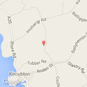
Chiffres
- Code pays :
- GB
- Code postal :
- BT22
- Latitude :
- 54.49970
- Longitude :
- -5.51750
- Zone horaire :
- Europe/London
- Fuseau horaire :
- UTC
- Heure d'été :
- Y
La ville de Newtownards appartient à la nation Northern Ireland et au comté Ards.
La ville de Newtownards compte 27 821 habitants (recensement de 2001).
Le nom français de la ville est Newtownards.
©photo-libre.fr