Ville de Mullyned (Northern Ireland)
Informations
Chiffres
- Code pays :
- GB
- Code postal :
- BT92
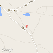
- Latitude :
- 54.20385
- Longitude :
- -7.37553
- Zone horaire :
- Europe/London
- Fuseau horaire :
- UTC
- Heure d'été :
- Y
La ville de Mullyned appartient à la nation Northern Ireland, au comté Fermanagh et au district Newtownbutler.
©photo-libre.fr