Ville de Market Drayton (England)
Informations
Chiffres
- Code pays :
- GB
- Code postal :
- TF9
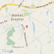
- Latitude :
- 52.89558
- Longitude :
- -2.47234
- Zone horaire :
- Europe/London
- Fuseau horaire :
- UTC
- Heure d'été :
- Y
La ville de Market Drayton appartient à la nation England, au comté Staffordshire et au district Newcastle-under-Lyme.
La ville de Market Drayton compte 10 407 habitants (recensement de 2000).
Le nom français de la ville est Market Drayton.
©photo-libre.fr