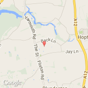
Ville de Lound (England)

royaume-uni

Informations

Chiffres

Code pays :
GB
Code postal :
NR32
Latitude :
52.53476
Longitude :
1.69648
Zone horaire :
Europe/London
Fuseau horaire :
UTC
Heure d'été :
Y

La ville de Lound appartient à la nation England, au comté Suffolk et au district Waveney.

Villes voisines

  • Blundeston ~2 km
  • Beacon Park ~3 km
  • Browston ~3 km
  • Hopton ~2 km
  • Ashby ~2 km
  • Flixton ~4 km
  • Somerleyton ~3 km
  • Bradwell ~5 km
  • Gorleston ~5 km

Les transports de Lound

Autre transport
Norwich ~32 km
Booking.com

Rejoignez-nous !

Vous aimez ? Partagez !