Ville de Longford (England)
Informations
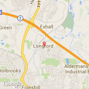
Chiffres
- Code pays :
- GB
- Code postal :
- CV6
- Latitude :
- 52.45291
- Longitude :
- -1.48460
- Zone horaire :
- Europe/London
- Fuseau horaire :
- UTC
- Heure d'été :
- Y
La ville de Longford appartient à la nation England, au comté West Midlands et au district Coventry.
La ville de Longford compte 8 836 habitants (recensement de 2011). L'altitude moyenne est de 72 m.
Le nom anglais de la ville est Longford.
©photo-libre.fr