Ville de Londonderry (Northern Ireland)
Informations
Chiffres
- Code pays :
- GB
- Code postal :
- BT48
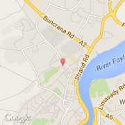
- Latitude :
- 55.00846
- Longitude :
- -7.32845
- Zone horaire :
- Europe/London
- Fuseau horaire :
- UTC
- Heure d'été :
- Y
La ville de Londonderry appartient à la nation Northern Ireland et au comté Derry City.
La ville de Londonderry compte 108 652 habitants (recensement de 2008).
Le maire de la ville de Londonderry est actuellement Paul Flemming (Sinn Féin).
Le nom français de la ville est Derry, le nom espagnol est Derry/Doire.
La devise de Londonderry est "Vita Victoria Veritas". Le site Internet de Londonderry est http://www.derrycity.gov.uk
©photo-libre.fr