Ville de Lightcliffe (England)
Informations
Chiffres
- Code pays :
- GB
- Code postal :
- HX3
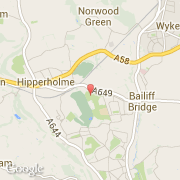
- Latitude :
- 53.72350
- Longitude :
- -1.79338
- Zone horaire :
- Europe/London
- Fuseau horaire :
- UTC
- Heure d'été :
- Y
La ville de Lightcliffe appartient à la nation England, au comté West Yorkshire et au district Calderdale.
©photo-libre.fr