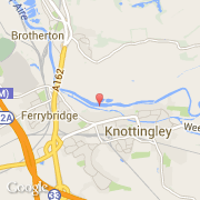
Ville de Knottingley (England)
Informations
Chiffres
- Code pays :
- GB
- Code postal :
- WF11
- Latitude :
- 53.71152
- Longitude :
- -1.25559
- Zone horaire :
- Europe/London
- Fuseau horaire :
- UTC
- Heure d'été :
- Y
La ville de Knottingley appartient à la nation England, au comté West Yorkshire et au district Wakefield.
La ville de Knottingley compte 13 503 habitants.
©photo-libre.fr