Ville de Hook Norton (England)
Informations
Chiffres
- Code pays :
- GB
- Code postal :
- OX15
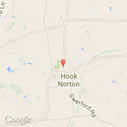
- Latitude :
- 51.99843
- Longitude :
- -1.48460
- Zone horaire :
- Europe/London
- Fuseau horaire :
- UTC
- Heure d'été :
- Y
La ville de Hook Norton appartient à la nation England, au comté Oxfordshire et au district Cherwell.
©photo-libre.fr