Ville de Higham-on-the-Hill (England)
Informations
Chiffres
- Code pays :
- GB
- Code postal :
- CV13
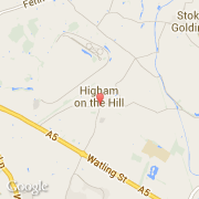
- Latitude :
- 52.55526
- Longitude :
- -1.44007
- Zone horaire :
- Europe/London
- Fuseau horaire :
- UTC
- Heure d'été :
- Y
La ville de Higham-on-the-Hill appartient à la nation England, au comté Leicestershire et au district Hinckley and Bosworth.
©photo-libre.fr