Ville de Headcorn (England)
Informations
Chiffres
- Code pays :
- GB
- Code postal :
- TN27
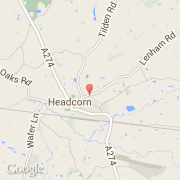
- Latitude :
- 51.17063
- Longitude :
- 0.62689
- Zone horaire :
- Europe/London
- Fuseau horaire :
- UTC
- Heure d'été :
- Y
La ville de Headcorn appartient à la nation England, au comté Kent et au district Tunbridge Wells.
La ville de Headcorn compte 3 241 habitants.
Le site Internet de Headcorn est http://www.neighbourhood.statistics.gov.uk
©photo-libre.fr