Ville de Dunstable (England)
Informations
Chiffres
- Code pays :
- GB
- Code postal :
- LU5
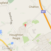
- Latitude :
- 51.91073
- Longitude :
- -0.51375
- Zone horaire :
- Europe/London
- Fuseau horaire :
- UTC
- Heure d'été :
- Y
La ville de Dunstable appartient à la nation England, au comté Bedfordshire et au district South Bedfordshire.
La ville de Dunstable compte 33 805 habitants (recensement de 2001).
Le nom français de la ville est Dunstable.
Le site Internet de Dunstable est http://www.dunstable.gov.uk
©photo-libre.fr