Ville de Downholland (England)
Informations
Chiffres
- Code pays :
- GB
- Code postal :
- L39
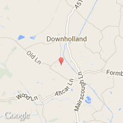
- Latitude :
- 53.55759
- Longitude :
- -2.96919
- Zone horaire :
- Europe/London
- Fuseau horaire :
- UTC
- Heure d'été :
- Y
La ville de Downholland appartient à la nation England, au comté Lancashire et au district West Lancashire.
La capital de la ville de Downholland est Parish.
Le nom anglais de la ville est Downholland.
©photo-libre.fr