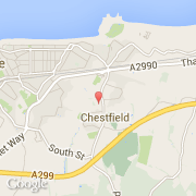
Ville de Chestfield (England)
Informations
Chiffres
- Code pays :
- GB
- Code postal :
- CT5
- Latitude :
- 51.35291
- Longitude :
- 1.06338
- Zone horaire :
- Europe/London
- Fuseau horaire :
- UTC
- Heure d'été :
- Y
Informations
Chiffres
Villes voisines
Les transports de Chestfield
Informations
Chiffres
Villes voisines
Les transports de Chestfield