Ville de Chesterfield (England)
Informations
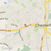
Chiffres
- Code pays :
- GB
- Code postal :
- S44
- Latitude :
- 53.22492
- Longitude :
- -1.31456
- Zone horaire :
- Europe/London
- Fuseau horaire :
- UTC
- Heure d'été :
- Y
La ville de Chesterfield appartient à la nation England, au comté Derbyshire et au district Bolsover.
Le maire de la ville de Chesterfield est actuellement Chesterfield Borough Council.
Le nom anglais de la ville est Borough of Chesterfield.
Le site Internet de Chesterfield est http://www.chesterfield.gov.uk
©photo-libre.fr