Ville de Buxted (England)
Informations
Chiffres
- Code pays :
- GB
- Code postal :
- TN22
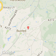
- Latitude :
- 50.98998
- Longitude :
- 0.13988
- Zone horaire :
- Europe/London
- Fuseau horaire :
- UTC
- Heure d'été :
- Y
La ville de Buxted appartient à la nation England, au comté East Sussex et au district Wealden.
La ville de Buxted s'étend sur 21,6 km² et compte 3 145 habitants pour une densité de 145,60 habitants par km².
Le site Internet de Buxted est http://buxtedparish.org.uk
©photo-libre.fr