Ville de Barrow-upon-Humber (England)
Informations
Chiffres
- Code pays :
- GB
- Code postal :
- DN19
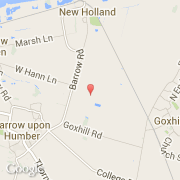
- Latitude :
- 53.68328
- Longitude :
- -0.35906
- Zone horaire :
- Europe/London
- Fuseau horaire :
- UTC
- Heure d'été :
- Y
La ville de Barrow-upon-Humber appartient à la nation England, au comté Lincolnshire et au district North Lincolnshire.
©photo-libre.fr