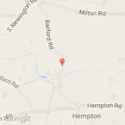
Ville de Barford St John (England)
Informations
Chiffres
- Code pays :
- GB
- Code postal :
- OX15
- Latitude :
- 51.99499
- Longitude :
- -1.36406
- Zone horaire :
- Europe/London
- Fuseau horaire :
- UTC
- Heure d'été :
- Y
La ville de Barford St John appartient à la nation England, au comté Oxfordshire et au district Cherwell.
Le site Internet de Barford St John est http://www.cherwell.gov.uk
©photo-libre.fr