Ville de Senohraby (Hlavní město Praha)
Informations
Chiffres
- Code pays :
- CZ
- Code postal :
- 251-66
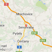
- Latitude :
- 49.89480
- Longitude :
- 14.71793
- Zone horaire :
- Europe/Prague
- Fuseau horaire :
- UTC+1
- Heure d'été :
- Y
La ville de Senohraby appartient à la région Hlavní město Praha, au district Praha-východ et à la commune Senohraby.
©photo-libre.fr