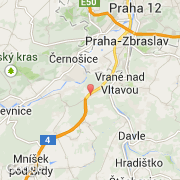
Ville de Jíloviště (Hlavní město Praha)
Informations
Chiffres
- Code pays :
- CZ
- Code postal :
- 252-02
- Latitude :
- 49.92717
- Longitude :
- 14.34290
- Zone horaire :
- Europe/Prague
- Fuseau horaire :
- UTC+1
- Heure d'été :
- Y
La ville de Jíloviště appartient à la région Hlavní město Praha, au district Praha-západ et à la commune Jíloviště.
©photo-libre.fr