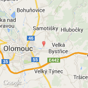
Ville de Bystrovany (Olomoucký kraj)
Informations
Chiffres
- Code pays :
- CZ
- Code postal :
- 779-00
- Latitude :
- 49.59637
- Longitude :
- 17.32370
- Zone horaire :
- Europe/Prague
- Fuseau horaire :
- UTC+1
- Heure d'été :
- Y
La ville de Bystrovany appartient à la région Olomoucký kraj, au district Olomouc et à la commune Olomouc.
La ville de Bystrovany s'étend sur 3,48 km² et compte 834 habitants (recensement de 2006) pour une densité de 239,66 habitants par km². L'altitude moyenne est de 231 m.
Le nom anglais de la ville est Bystrovany.
Le site Internet de Bystrovany est http://www.bystrovany.cz
©photo-libre.fr